Climb to Mount Ararat - route description
from Camp 1 to Ararat summit
• start point: Camp 1 (4120m)• final point: Ararat summit (5165m)
• ascent duration:
 4hrs to 6hrs 30mins
• height meters to beat:
 1050m
1050m• huts along the route: none
• water along the route: none (only snow/ice)
• i walked this route: july 2013
• gear needed:
- sturdy mountains boots, crampons, trekking poles
- ice axe (if snow covers also steeper slopes from 4600m above, usually in june and beg. of july)
- there is a risk of rockfall between 4400 and 4650m, consider taking helmet (approximately half of people, i have seen during the climb, had one)
• difficulty:
- usually classified as PD-
- rocky terrain, but no climbing
- high altitude
- easy glacier walk above 4950m; in the beginning of the season snowfields up to 40 deg
- climb starts usually around 2AM, so large part of the ascent happens during the night
• route description:
- from C1 climb direct up the steep rocky ridge towards small rock tower
- at 4300m one passes this rock tower from it's right side
- follows gentle part over stones to app. 4400m
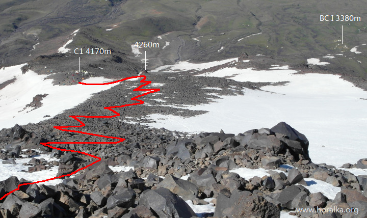
first stretch above Camp 1
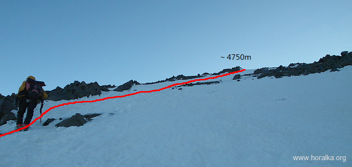
- further it's a steep climb in short zigzags over stones and small boulders to 4620m (snow from here beg. of July)
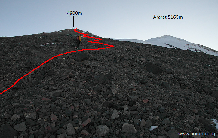
- the slope gets bit more gentle from here up to almost 4800m, from where the summit gets visible
part above P4620m
slope beneath the glacier
- then one walks quite easily over scree, following a broad ridge up to 4950m, where the glacier begins
- quite fast one reaches the summit plateau at 5030m - 5070m
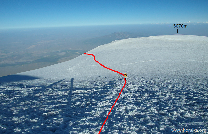
part of the route over the glacier plateau between 4950m and 5100m
- from a barely visible col at 5050m one walks up the final, around 35 degrees steep slope to the Ararat summit (5165m)
- summit is not signed, just some remnants of steel sticks and some steel box
- views from the top are unfortunately often bit limited with haze in the lowland
- but on a clear day one can spot Aragats (4095m) in Armenia to the north
- towards south and southwest then Tendurek Dagi (3542m) and Suphan Dagi (4058m)
- and last but not least in the west one can see eastern part of the Kackar Mountains
|
vedlejší ulice;
počasí v alpách sněžnice english deutsch co a kdy jsem vylezl plánované akce |
odkazy; phototravels - fotky z cest miloš růžička - horské praktikum výměna odkazů |
navigace; nahoru zpět |
horalka.org; podmínky použití kontakt |
© 2000 - 2024 david smrkovský