Langtang Himal - Laurebina La & Gosainkund Lake Trekking
from Singh Gompa via Cholangpati to Laurebina Yak
• start point: Singh Gompa (3270m)• final point: Laurebina Yak (3910m)
• ascend time:
 2hrs 30min to 4hrs
• height meters to beat:
 700m
700m• huts along the route: Cholangpati (3584m)
• water along the route: no
• i walked this route: March 2012
• equipment needed: standard mountaineering / trekking gear
• difficulty: walk-up, partially steep
• route description:
- the first part is a gentle traverse of southern slope, partially leading thru forrest or bush vegetation
- at approx. 3450m follows a short descent to small saddle
- the path moves into a pine wood on the northern side of the ridge (in the second half of March 2012, all was under hard snow here)
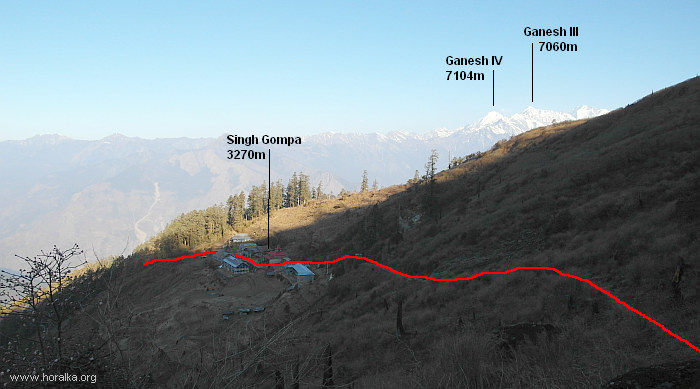
beginning of the ascent at Singh Gompa
- during the walk thru the wood, occasionally Langtang Lirung can be seen behind the trees
- at around 3550m the path leaves forrest and with a barely upwards leading path one reaches lodges at Cholangpati
- small settlement with two lodges at 3584m
- at 3700m the path gets above the vegetation line and one can admire Manaslu, Ganesh Himal in the west or Langtang Lirung in the north
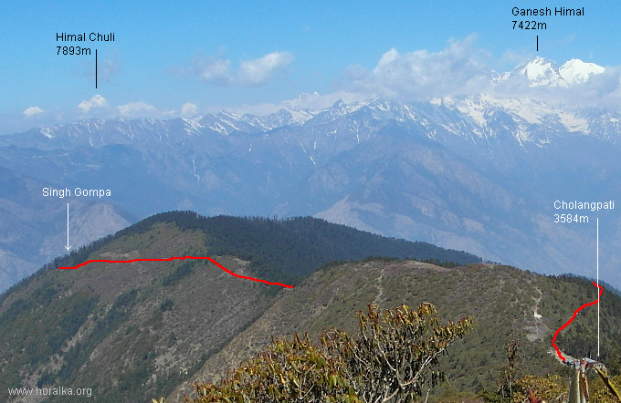
part of the walk between 3350m and 3600m
- walking upwards a grassy ridge one reaches lodges at Laurebina Yak (3910m); around an hour walk from Cholangpati
|
vedlejší ulice;
počasí v alpách sněžnice english deutsch co a kdy jsem vylezl plánované akce |
odkazy; phototravels - fotky z cest miloš růžička - horské praktikum výměna odkazů |
navigace; nahoru zpět |
horalka.org; podmínky použití kontakt |
© 2000 - 2024 david smrkovský