
Forecast was promising a good weather for upcoming Friday and weekend and avalanche risk did drop to level 1 to 2, so on Thursday afternoon i'm making a drive to Oetztal Alps in Austria. All goes well and at 11PM i'm parking just few kilometres ahead of Vent, where the trail to Similaun begins. Next day morning i'm packing all my stuff and drive the last few kilometres to Vent. At 9 AM i'm starting the walk to Similaun Hut, which lays below Similaun peak.
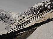
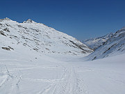
route through the Niedertal Valley to Martin Busch Hut, in the back Similaun |
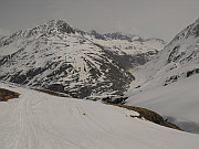
above Martin Busch Hut (2501m), in the back Diemkogel Ridge (3400m) |
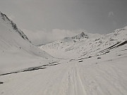
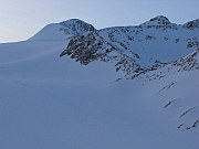
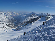
walking towards Similaun Hut, on the right Hauslabkogel (3404m) |
After a short steep section in the beginning a long traverse thru Niedertal Valley begins. During winter the route is heavily exposed to avalanches and numerous snow barriers laying over the trail proof that. When i reached Martin Busch Hut (2501m), the weather got worse and shortly all was covered in fog. My speed went down and in total it took me over 6 hrs to reach Similaun Hut (3019m). I had reservation for the night, which turned to be smart, since the hut was full.
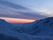
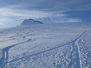
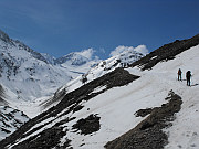
early in the morning of the second day... |
Similaun seen from the hut |
the summit is getting closer... |
I woke up shortly after 5AM and a look out of the window made me horny for the climb. No fog and clear views outside. After a small breakfast i packed all my gear and started to make my way towards the Similaun summit. The route was flat, than got steeper and over another flat plateau one got below a steep slope, which leads to final summit ridge. Thanks to the early start, the first groups of skialpinists were way behind me. After getting over the final ridge i did reach the summit, which i had just for myself. View around was wondeful - Oetztal Alps, Ortler in the south, Stubai Alps in the east. After 20 minutes on the top i'm starting the descent.
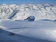
western part of the Oetztal Alps |
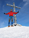
8:18 AM, summit reached |
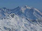
Hinterer Brochkogel (3635m), Wildspitze (3772m) and Kreuzspitze (3457m) |
Down to 2900m altitude it goes pretty quickly as the snow is more or less powder, but further down it's a torture, since sun made the snow too soft to walk in even with snowshoes. When i'm at the end of Niedertal Valley, i hear something like thunder behind my back - a big avalanche is falling down, running accross the trail to the bottom of the valley. If I had been descending some 45 minutes later... Past 2PM i'm at my car a in less than an hour i'm on my way back to Prague.
Niedertal Valley, Grosses Ramolkogel (3551m), in the backround Stubai Alps |
descending, on the left is Kreuzkogel (3340m) and Kreuzspitze (3457m) |
and once more view back... |