Climb to Mount Ararat - route description
from Elli Koy village to Mount Ararat Base Camp
• start point: Elli Koy (2150m)• final point: Ararat Base Camp (3350m)
• ascent time:
 4hrs 30mins to 6hrs
• height meters to beat:
 1250m
1250m• huts along the route: only nomad camps (can get a tea)
• water along the route: no (might get some in nomad camp at 2550m)
• i walked this route: june 2013
• gear needed: standard mountaineering / trekking gear
• difficulty:
- just walking on clear paths; rocky above 3150m
• route description:
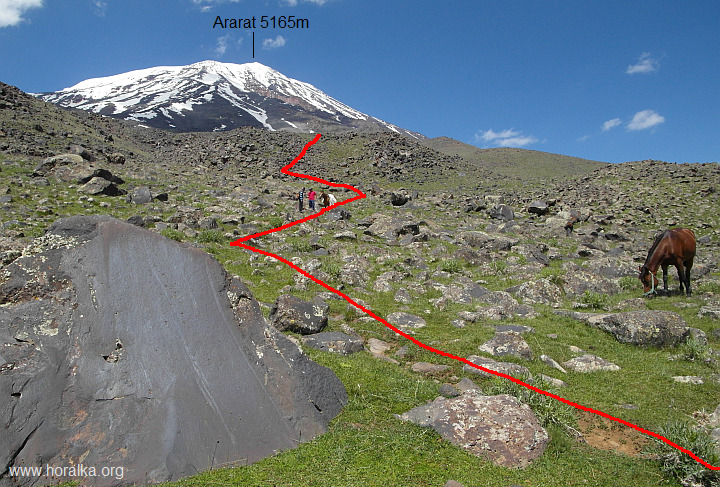
The walk up to Ararat BC is relatively long. One walks on gently steep paths over meadows below Ararat. It's bit hard to describe the route in detail since it's pretty monotonous without clear landmarks in the terrain. There is dozen of paths around and it's easy to hit wrong one - guide is good to have on this leg.
- the walk-up starts near Elli Koy village (2180m)
- van brings you slightly below the village to 2050-2150m
- follow gently ascending gravel road
- later one turns to small path and continues to walk over grassy slopes to first nomad camp at 2550m
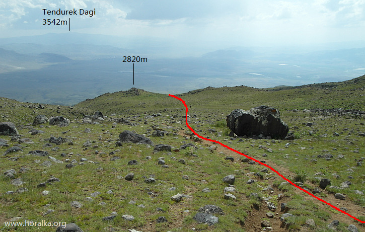
part of the route at around 2800m
- then it goes bit steeper to another two camps at 2750m and 2800m
- follows a long walk over gentle grassy plain, at 2950m on your right hand side you pass another nomad camp

steeper section beneath the last nomad camp
- one reaches the last camp at 3200m
- last stretch is bit a steeper, stony slope and gentle walk to meadow, where BC stands (3 separate meadows at 3340 - 3380m, coordinates: 39.678093,44.270103)
at 3150m
|
vedlejší ulice;
počasí v alpách sněžnice english deutsch co a kdy jsem vylezl plánované akce |
odkazy; phototravels - fotky z cest miloš růžička - horské praktikum výměna odkazů |
navigace; nahoru zpět |
horalka.org; podmínky použití kontakt |
© 2000 - 2024 david smrkovský