Volcanes de México - route descriptions
from Piedra Grande Basecamp to summit of Pico de Orizaba
• start point: Base Camp - Refugio Piedra Grande (4275m)• final point: Pico de Orizaba (5650m)
• time required:
 5hrs to 8hrs 30mins, descent then 3hrs to 4hrs
• height meters to beat:
 1410m
1410m• huts along the route: none
• water sources along the route: none
• i was here: November 2013
• gear:
- crampons, ice axe, (helmet), good to have trekking poles
- obviously warm clothes, heavy mountain boots, might be good to take baclava, ski goggles
- if there are crappy snow conditions, then section Laberinto can be icy and you might need ice screws (plus associated gear of course)
• difficulty:
- prior climb or even just overnight in base camp it's a must to make proper acclimatization
- route over Glaciar Jamapa is technically around PD to PD+
- extreme altitude
- Laberinto section between 4800m and 5000m can be technically more demanding under bad snow conditions
- snow/mixed slopes up to 45 degrees steep
- above 5050m technically easy, but long ascent over glacier
- steep rocky terrain
• route description:
- whole ascent from BC to summit can be easily divided into 3 sections:
- 1/ up to 4750m steep rocky/scree terrain
- 2/ from 4800m to 5050m mixed terrain
- 3/ above 5050m glacier
- first around 100 height meters above Refugio Piedra Grande (BC) one walks on concrete path (Acuaducto)
- yet prior it's end you will turn to the right to standard mountain path
- follows a steep zig-zag climb over scree/stone slope and one gains height quickly
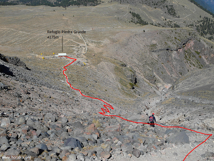
first part of the climb above BC
- terrain flattens above 4650m and in gentle climb one gets to 4750m, where the Laberinto section begings
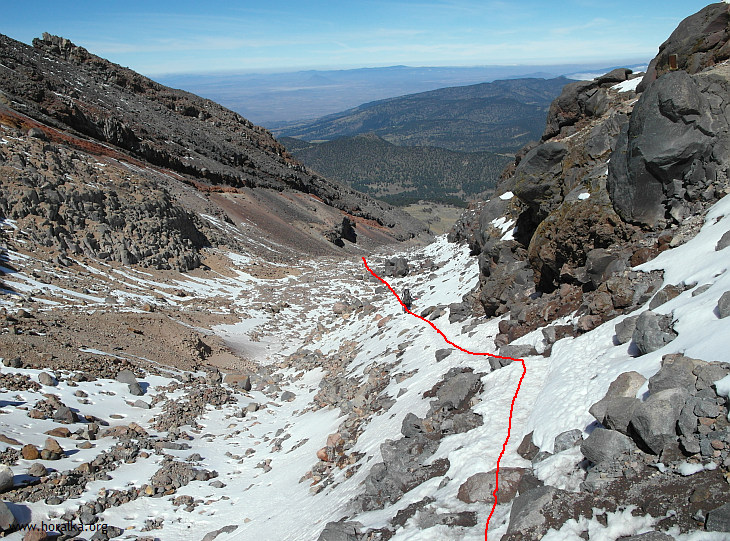
at around 4750m prior beginning of Laberinto
- Laberinto is a steep gullies mixed section, which can be relatively easy or on the other hand issue an halt
- difficulty depends on snow conditions, where it can anything between dry rock over frozen snow to pure ice
- in the last mentioned case you might need few icescrews to secure the steep gullies
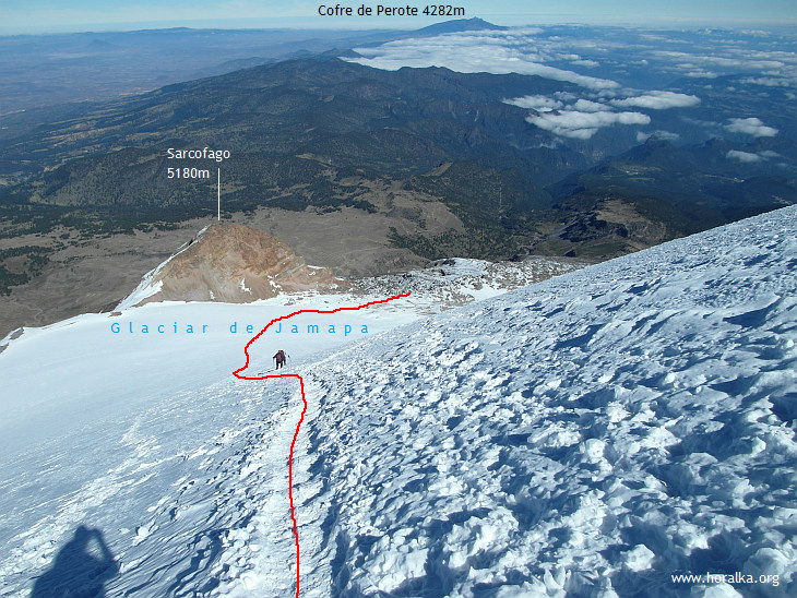
- slope is more gentle above 4950m and one gets to the beginning of Glaciar Jamapa at 5050m
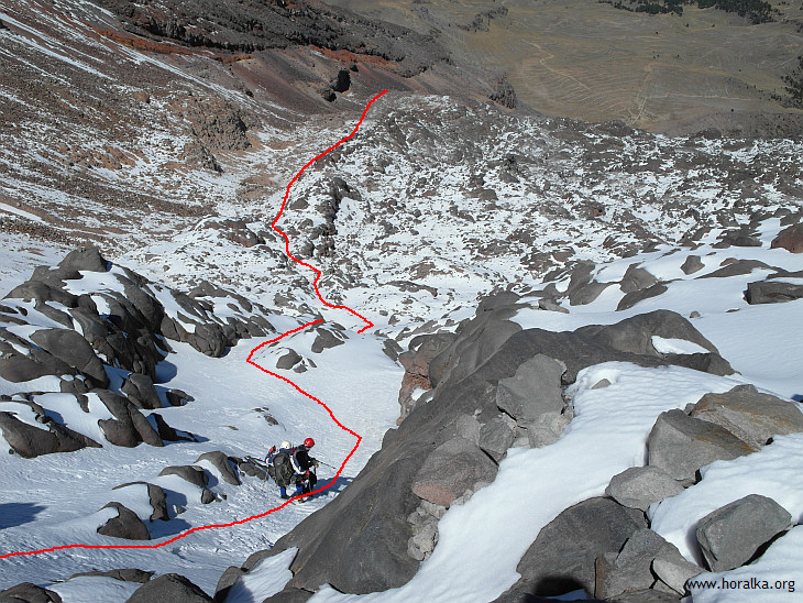
Laberinto section (when i was here in the end of Nov 2013, i enjoyed top of the top snow conditions)
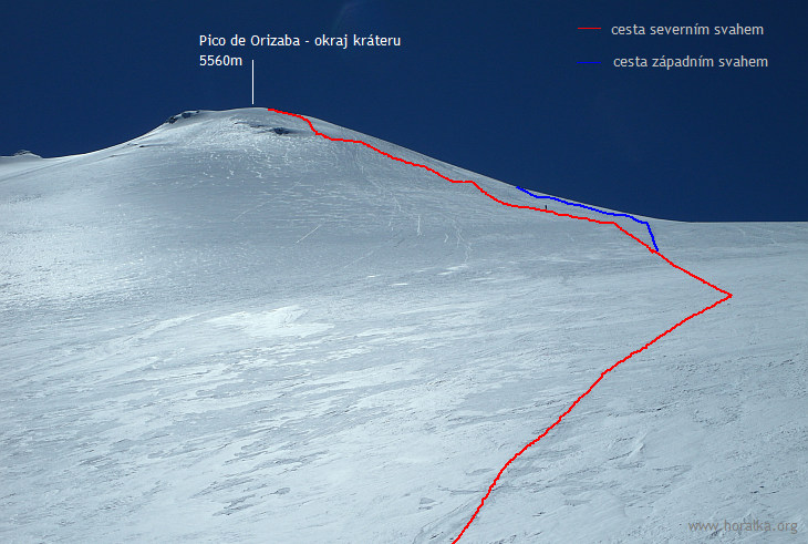
- above 5050m there is a vast snow/glacier slope covering the summit dome
- it looks shorter and less steep, than it actually is
- in principle, there are two paths via the glacier:
- 1/ direct thru right side of the glacier slope in front of you, at app. 5550m you reach crater rim and follow it to the summit
- 2/ same way the first maybe 100 or 150 height meters, abut then steer to the right and follow steep climb thru Orizaba's western slope to the summit
- i followed the second option and rather don't recommend - you walk longer in shadow and it's probably somewhat steeper than option 1
ascent over Glaciar de Jamapa - it's longer and steeper than it looks
- under nice weather you can enjoy views around large portion of Central Mexico including the Mexican Gulf
and a view from the summit on route from 5000m upwards
|
vedlejší ulice;
počasí v alpách sněžnice english deutsch co a kdy jsem vylezl plánované akce |
odkazy; phototravels - fotky z cest miloš růžička - horské praktikum výměna odkazů |
navigace; nahoru zpět |
horalka.org; podmínky použití kontakt |
© 2000 - 2024 david smrkovský