Walliské Alpy - popisy výstupů
from Weissmies Hut to Lagginhorn 4009m
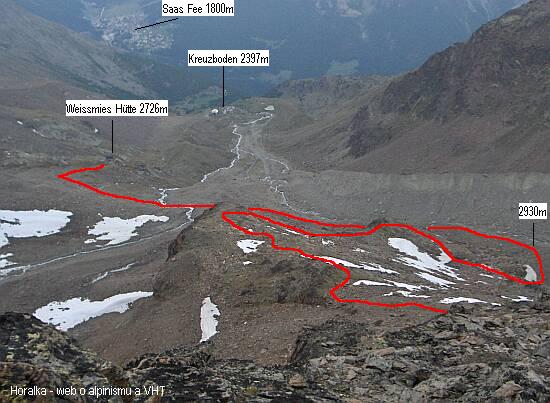
• starting point: Weissmies Hütte (2726m)

• final point: summit of Lagginhorn (4009m)
• ascend time:
 4hrs to 5hrs
• height meters to be climbed:
 1350m
1350m• huts along the route: none
• water sources along the route: none
• way number: not marked above 2900m
• i climbed this route: June 2005 (solo full West ridge)
• map: Weissmieshütte --> Lagginhorn
• gear: ice axe, crampons, helmet!, harness, short rope; gear required depends on snow conditions and on your ability to deal with UIAA II terrain!
• difficulty:
- PD+, Rock II, Snow/Ice max 40°
- not marked path above 2900m
- high altitude, AMS risks
- steep terrain, rock fall danger
- nothing for mountaineering rookies!
• route description:
- in general: the day before the climb, check out the first part of the route to the beginning of the glacier or beginning the West Ridge
Lower part of the climb - glacier option:
- follow the path upwards from Weissmies Hut, after crossing the first stream take right path
- trail goes below moraine which is climbed later in zig-zags
- from the top of the moraine it's some 10 minutes to the beginning of Lagginhorn glacier
- rockfall danger from Lagginhorn western wall down to the glacier
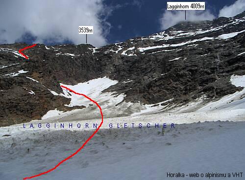
- the glacier is climbed in a light left turn up to the highest point of a glacier "bay"
- the very last part on the glacier is steep - around 40 degrees
- then follows rock scrambling up to P3470m on the West ridge
Lower part of the climb - full West ridge option:
- take the same path from the hut, but after crossing the first stream, go straight ahead
- you cross a second stream and the path climbs up on the top of glacier morain
- at 2930m turn right and start gaining the height on the West ridge
- the climb will be much easier, if you find (don't miss) the path which goes up on the right side of the ridge
Above 3500m the route is the same for both above described options:
- right after the meeting point of both routes, there's a rock plate graded II UIAA
- above that, it's only scrambling over stones and rocks, snowfields respectively
- between app. 3940m and 3990m is a steep snowfield - around 40 degrees
- this snow field ends right below the 4000m line and the last few height meters is an easy rockclimb
- small iron cross on the top
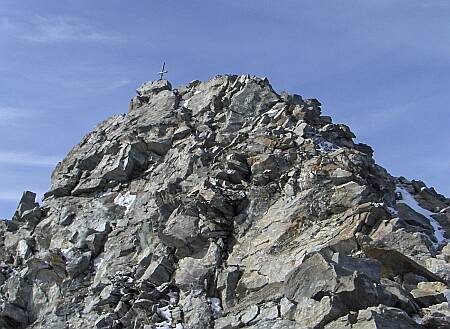
- great view from the summit - Monte Rosa, whole Mischabelgruppe with Dom and Nadelhorn etc. and of course his majesty Weisshorn in the West
|
vedlejší ulice;
počasí v alpách sněžnice english deutsch co a kdy jsem vylezl plánované akce |
odkazy; phototravels - fotky z cest miloš růžička - horské praktikum výměna odkazů |
navigace; nahoru zpět |
horalka.org; podmínky použití kontakt |
© 2000 - 2024 david smrkovský